search
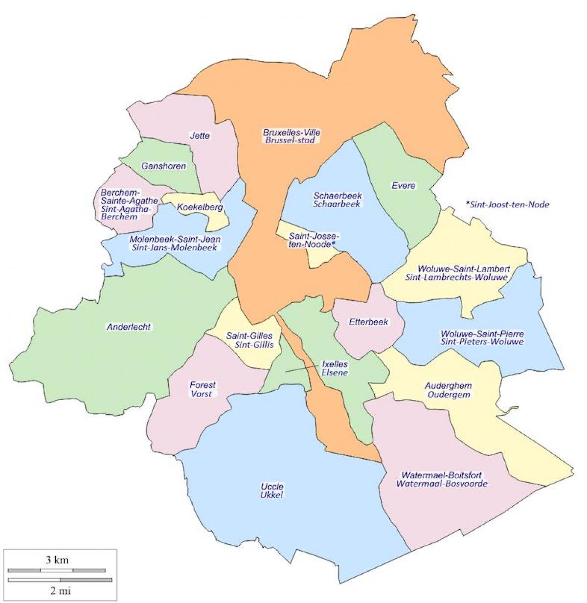
Brussels municipalities map
Bruxelles municipalities map. Brussels municipalities map (Belgium) to print. Brussels municipalities map (Belgium) to download. The 19 municipalities (communes) of the Brussels-Capital Region (as its shown in Brussels municipalities map) are political subdivisions with individual responsibilities for the handling of local level duties, such as law enforcement and the upkeep of schools and roads within its borders. Municipal administration of the Brussels municipalities is also conducted by a mayor, a council, and an executive.
The largest and most populous of the municipalities is the City of Brussels, covering 32.6 square kilometres (12.6 sq mi) with 145,917 inhabitants as its mentioned in Brussels municipalities map. The least populous in Brussels is Koekelberg with 18,541 inhabitants, while the smallest in area is Saint-Josse-ten-Noode, which is only 1.1 square kilometres (0.4 sq mi). Despite being the smallest municipality, Saint-Josse-ten-Noode has the highest population density of the 19 with 20,822 inhabitants per km2.


