
search
Brussels central station map
Map of Brussels central station. Brussels central station map (Belgium) to print. Brussels central station map (Belgium) to download. Bruxelles-Central / Brussel-Centraal (Brussels Central) is a metro and railway station in Brussels. Brussels central station is the busiest train station in Belgium and one of three principal train stations in Brussels, but handles primarily domestic traffic. (see Brussels central station map) First completed in 1952 after protracted delays caused by economic difficulties and war, Brussels central station is the newest of Brussels main rail hubs.
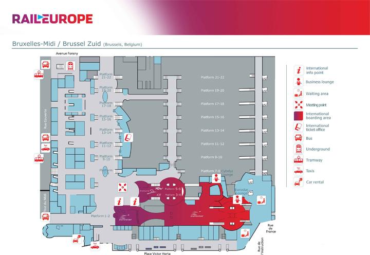
Brussels central station has six tracks, served by three island platforms as its shown in Brussels central station map. These are underground, beneath the city blocks within the "Boulevard de l'Impératrice/Keizerinlaan", "Rue de l'Infante Isabelle/Infante Isabella straat", "Kantersteen" and "Rue de la Putterie/Putterijstraat". Brussels central station is at the very heart of the city, its capacity is not adapted to present usage levels (ca. 70,000 passengers on a weekday), let alone future levels. The interior and the platforms of Brussels central station have been renovated in recent years, but the main problem (i.e. lack of capacity) has not fundamentally been addressed.