
search
Brussels old town map
Map of Brussels old town. Brussels old town map (Belgium) to print. Brussels old town map (Belgium) to download. The historic Old Town of inner Brussels forms the centre of the modern metropolis, but the pentagonal walls that once surrounded Brussels old town were replaced by a ring of tree-lined boulevards in the early 19th century as its shown in Brussels old town map. Since 1830, when Belgium became an independent kingdom, Brussels has continued to be transformed, in the Old Town as well as in the surrounding communes.
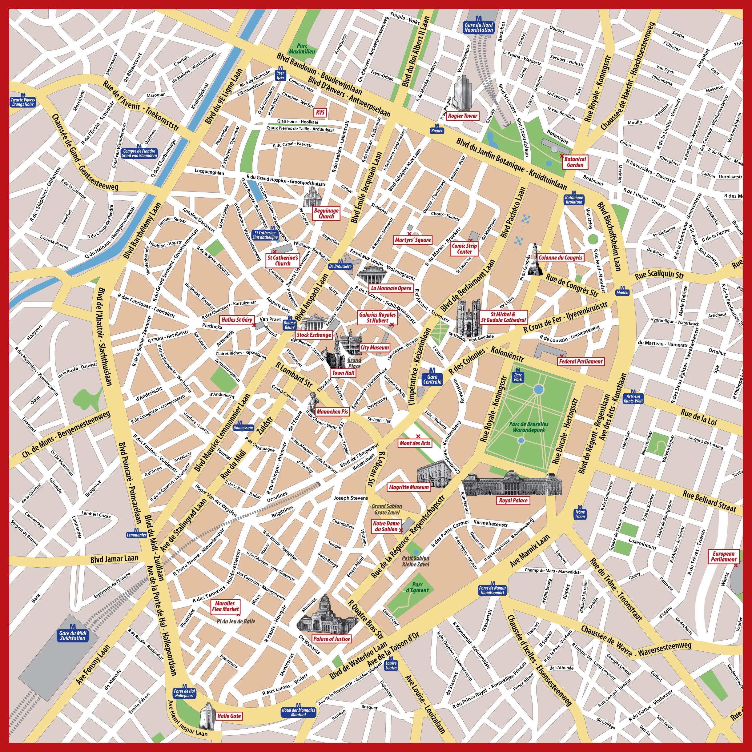
The Old Town (La Vieille Ville) is the most attractive part of Brussels, situated in the heart of the city center (Centre-Ville) as its mentioned in Brussels old town map. Brussels old town is centered around Grand Place and consist of small scale, partly pedestrian streets with small beautiful historic buildings. In Brussels old town you will find Manneken Pis, the very small statue of a pissing boy that has became the foremost symbol of Brussels, as well as the historic shopping galleria St-Hubert. Some streets just next to Galeries Royale St-Hubert have cozy open-air restaurants and an atmosphere that resembles both Paris and Southern EuropCompared to other European capitals, Brussels can appear a bit "dry", since it is not situated by a sea, any major lake or river.