
search
Stib Brussels map
Brussels transit map. Stib Brussels map (Belgium) to print. Stib Brussels map (Belgium) to download. The Brussels Intercommunal Transport Company (French: Société des Transports Intercommunaux de Bruxelles or STIB) or (Dutch: Maatschappij voor het Intercommunaal Vervoer te Brussel or MIVB) is the local public transport operator in Brussels, Belgium. Stib Brussels is usually referred to as the STIB in English. stib Brussels is responsible for the Brussels metro, Brussels trams and Brussels buses and for links with De Lijn services in Flanders and TEC services in Wallonia (see stib Brussels map).
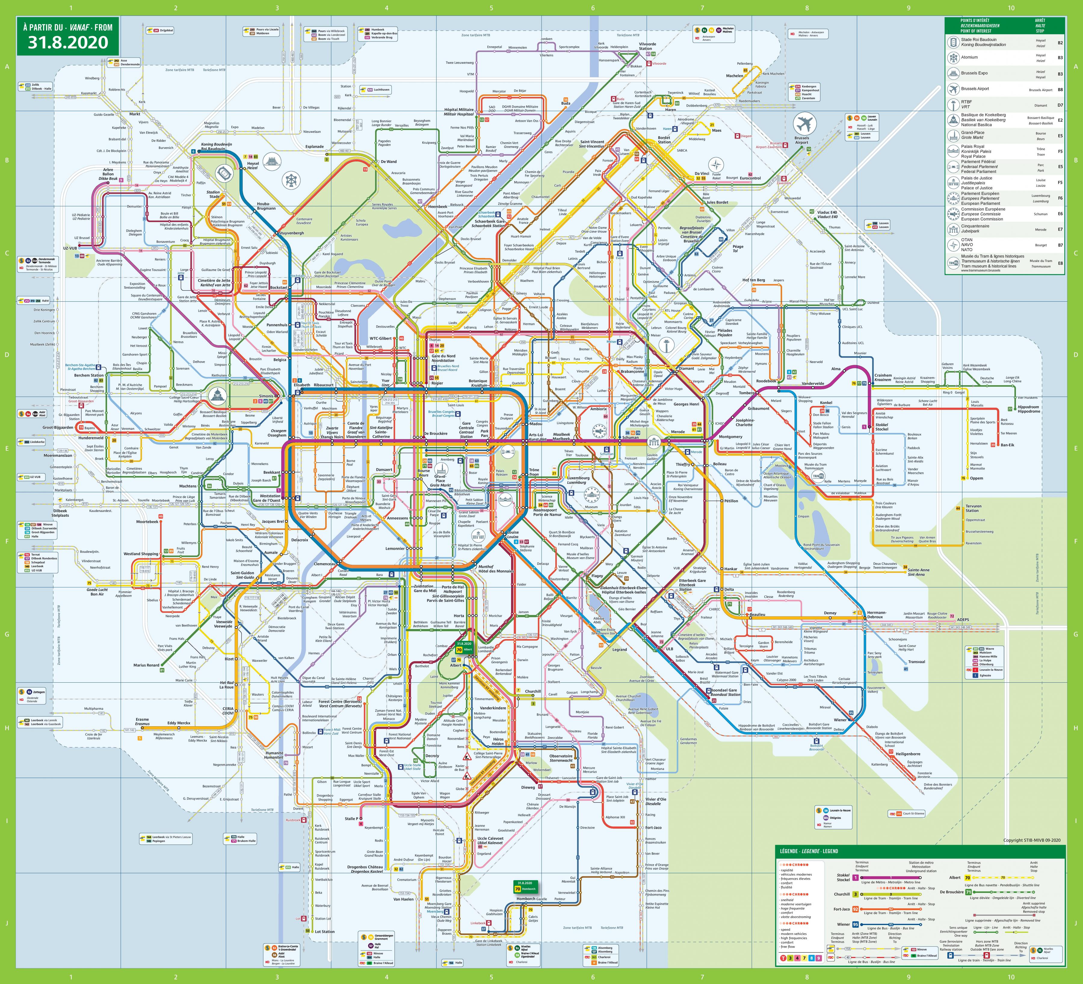
Founded in 1954, the stib Brussels currently operates a network of 6 metro lines of (39 km), 15 tram lines (128.3 km) and 51 bus routes (348.8 km) as its shown in stib Brussels map. Stib Brussels covers the 19 communes of the Brussels Capital Region and some surface routes extend to the near suburbs in the other Belgian regions. There are about 277 million passengers a year, so about 760,000 a day. Typical tickets are valid for 1 hour of travel on the network; these can be purchased in groups of 10 at a discount. Period season tickets are also available. As of 1991, the stib Brussels had a farebox recovery ratio of 28%.