
search
Brussels midi railway station map
Brussels midi train station map. Brussels midi railway station map (Belgium) to print. Brussels midi railway station map (Belgium) to download. Brussels midi railway station is the main hub station used by all mainline trains serving Brussels including Eurostar to London, Thalys to Paris, Amsterdam & Cologne, German Railways ICEs to Cologne & Frankfurt, Intercity trains to Luxembourg and Belgian domestic trains to Bruges, Ghent, Antwerp & so on as its shown in Brussels midi railway station map. Changing trains is easy and only takes a few minutes. The Brussels midi railway station in French, Brussel Zuid in Flemish, Brussels South Station in English - it's all the same place.
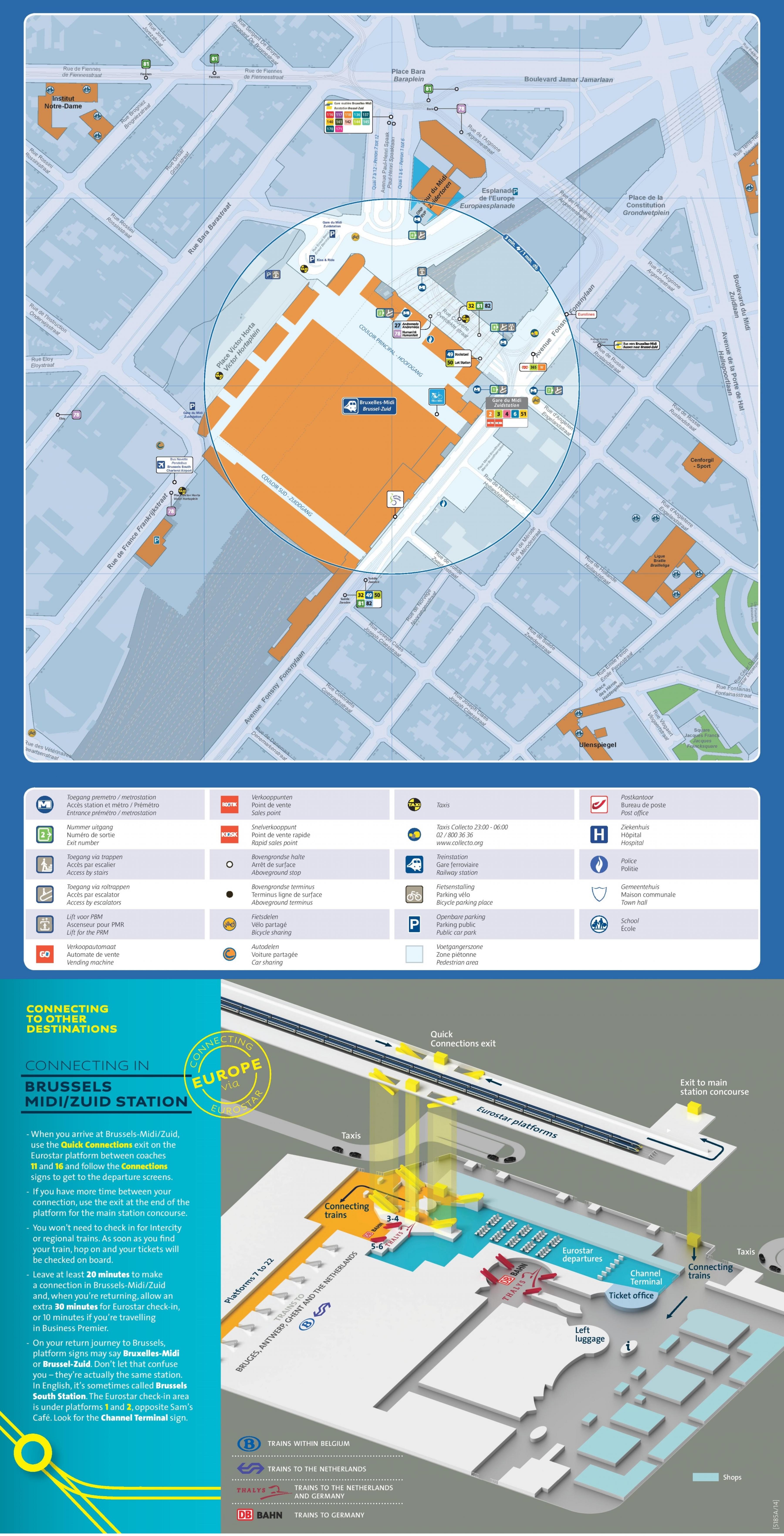
The main concourse (couloir principal) of Brussels midi railway station is a wide and somewhat gloomy street-level passageway underneath all the tracks, which pass overhead on a viaduct above street level. There are escalators and stairs up to each of the 22 platforms as its mentioned in Brussels midi railway station map. A similar but much narrower passageway connects all the platforms a hundred yards to the south, called the couloir sud. Incidentally, Brussels midi railway station was originally opened as a terminus in 1869. Brussels Nord was also originally a terminus. In 1952, the 3.8km Jonction Nord-Midi line opened through the centre of Brussels linking Brussels Nord, Brussels Central & Brussels Midi. This turned Nord & Midi into through stations and enabled Brussels midi railway station to become the main hub for all trains serving Brussels.