
search
Brussels region map
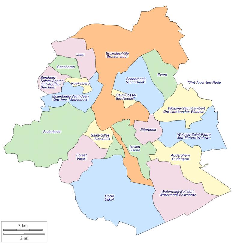
Bruxelles region map. Brussels region map (Belgium) to print. Brussels region map (Belgium) to download. The Brussels-Capital Region was formed on 18 June 1989 after a constitutional reform in 1988. Brussels region has bilingual status and it is one of the three federal regions of Belgium, along with Flanders and Wallonia (see Brussels region map). In 1831, Belgium was divided into 2,739 municipalities, including the 19 in the Brussels-Capital Region. Unlike most of the municipalities in Belgium, the ones located in the Brussels-Capital Region were not merged with others during mergers occurring in 1964, 1970, and 1975.
The Brussels-Capital Region is one of the three Regions of Belgium, while the French Community of Belgium and the Flemish Community do exercise, each for their part, their cultural competencies on the territory of the Region (see Brussels region map). French and Dutch are the official languages; most public services are bilingual (exceptions being education and a couple of others). The Capital Region is predominantly French-speaking—about 60–85% of the population are French-speakers (including migrants and second language speakers), and about 10–15% are native Dutch-speakers.