
search
Brussels transport map
Bruxelles transport map. Brussels transport map (Belgium) to print. Brussels transport map (Belgium) to download. Public transport in Brussels is very efficient. Having said this, using the trams and buses can be more complicated than it needs to be, with few maps and fewer connections (see Brussels transport map). The night Brussels transport network of STIB (night buses during the weekend) is called Noctis. There is also another Brussels transport which is the Waterbus, it is a bus service on the water between Vilvoorde and Brussels, a 10-kilometer navigational route on the Senne Canal.
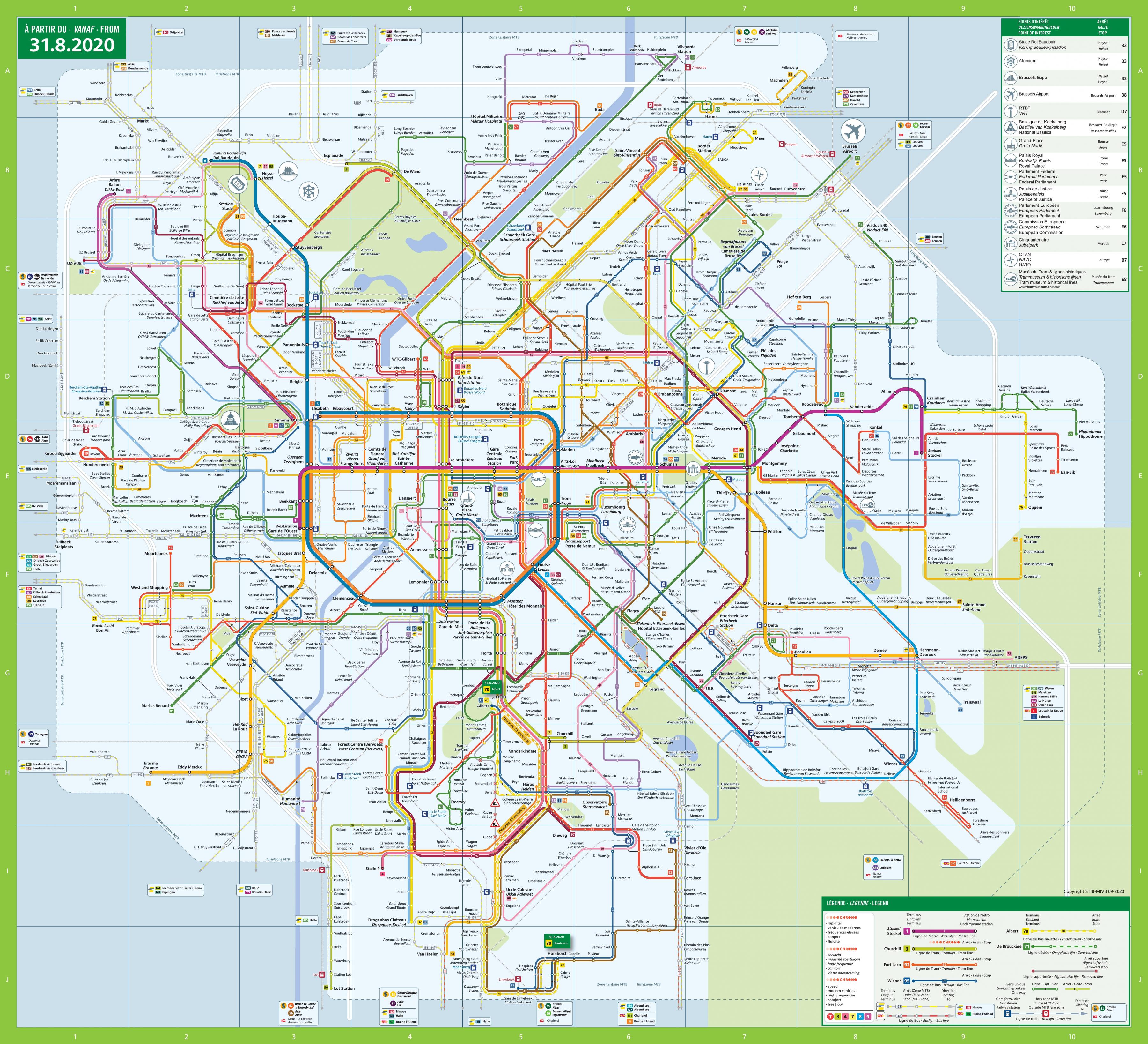
Most public transport in the Brussels-Capital Region is organized by the STIB (Société des Transports intercommunaux bruxellois). The Brussels transport network includes metro lines, which connect the eastern and western districts of the city as its shown in Brussels transport map. Pre-metro lines (trams in the tunnels) complete the metro service. A great many Brussels metro lines also have above ground bus and tram connections.
In Brussels public transport with contactless payment, you can pay for your trip using your contactless bank card (debit or credit), smartphone or smartwatch. Every STIB bus, tram and metro station is equipped with a specific contactless payment device (see Brussels transport map). This device of Brussels transport supports any bank card with the contactless logo. For smartphones and smartwatches, compatible payment applications are Google Pay, Apple Pay, Fitbit Pay and Garmin Pay.